Ħal Kirkop / Western Region

From St Leonard’s square

The church towers give Kirkop a landmark. The prehistoric menhir, local sports grounds and bus stops tell you more about how the village fits into this part of Malta.

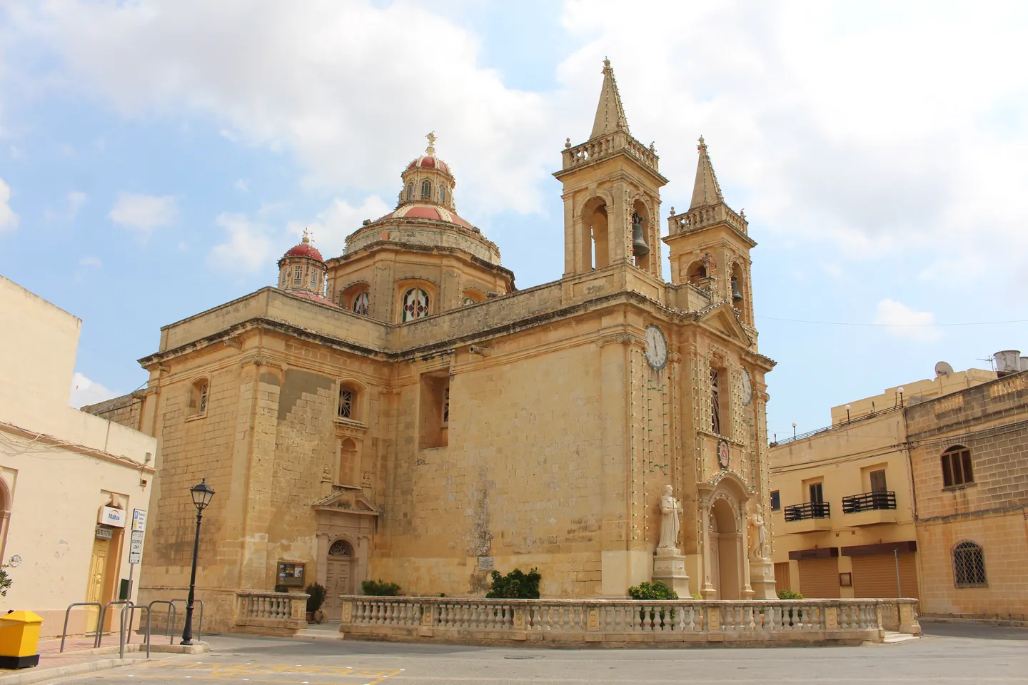
Limestone St Leonard’s church with a red dome and two bell towers behind the stone balustrade.
St Leonard’s parish church, 11 September 2016. IsaacBTTF / Wikimedia Commons · CC BY-SA 3.0. Resized and converted to WebP.

Two landmarks, different histories

The parish stands on Misraħ San’ Anard. The menhir takes Kirkop’s history much further back, to a period whose traces are harder to interpret.

St Leonard’s parish

Start in the square for a view of the dome, the twin bell towers and the balustrade. The church is recorded as item 01870 in the national heritage inventory. Check with the parish before planning an interior visit.

Archdiocese parish information ↗

The menhir

The local council identifies the standing stone as a prehistoric monolith and a symbol of Kirkop. Its original purpose remains uncertain.

Local council heritage notes ↗

Getting around and getting things done

Public transport

Valletta and Żurrieq

Route 73 runs via Kirkop. Leonardu and Guzeppi appear in the timetable with different stop numbers by direction. Check the operator’s timetable for your travel date.

Route 73 timetable ↗
Health services

Kirkop Health Centre

The centre is on Triq Danny Cremona. Check Primary HealthCare’s current service and appointment information before attending.

Health centre information ↗
Local recreation

Sports complex and football ground

The council lists both facilities in Kirkop. Confirm venue access and booking arrangements before planning a session.

Council sports directory ↗

From the square to Triq il-Barrieri

Malta Tourism Authority records a snack bar on the parish square and a takeaway on Triq il-Barrieri. Contact the venue for current trading hours and menus.

Find the parish square

The marker identifies St Leonard’s church. Use the map to place the square in the surrounding street network.

Map data © OpenStreetMap contributors.

Sources and nearby editions

Sources reviewed on 15 November 2026. The Address Registrar lists Ħal Kirkop in the Western Region and lists Ħal Luqa as a separate council in the Southern Region. When planning a journey between the villages, use the full address and check the direction on the operator’s timetable.

Nexus Marketplace

Explore Ħal Kirkop

See local homes and explore food, shops and everyday places around the neighbourhood.

Homes in Ħal Kirkop

Browse local listings

Places around Ħal Kirkop

Mapped places within 2 km of the centre. This can include nearby neighbourhoods.

Explore other neighbourhood editions