Il-Qrendi / Western Region

Qrendi, from village square to temple ridge

Begin at the Church of the Assumption. Beyond the village centre, St Matthew’s overlooks the Il-Maqluba conservation area, and Heritage Malta manages two Neolithic sites in a separate park.

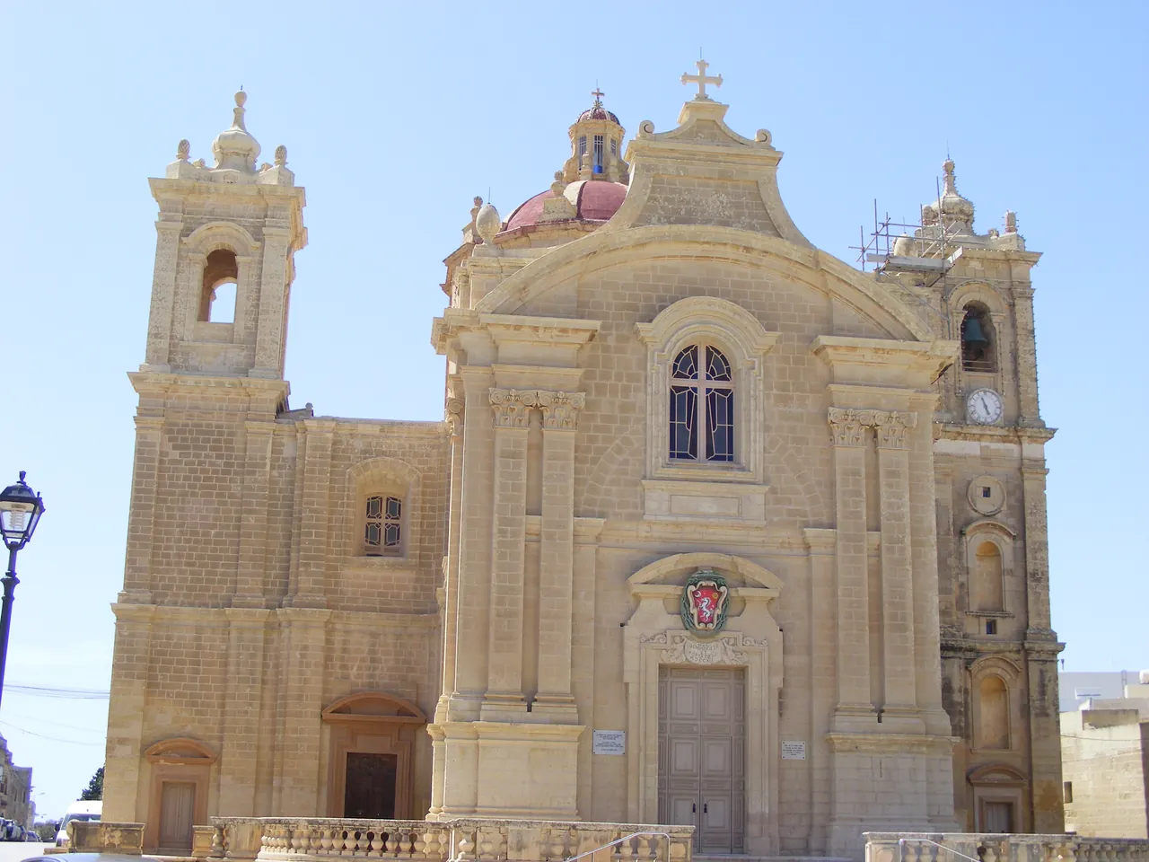
Limestone façade, red dome and bell towers of Qrendi’s Parish Church of the Assumption.
Parish Church of the Assumption, 2 May 2024. Pygar1954 / Wikimedia Commons · CC BY-SA 4.0. Resized and converted to WebP.

The parish, Il-Maqluba and the temples

The national inventory lists the Church of the Assumption as item 01778. Qrendi’s council traces the village’s parish history through neighbouring Żurrieq. Start with the façade and square, and check parish arrangements before planning an interior visit.

Council parish history ↗

St Matthew’s at Misraħ tal-Maqluba

St Matthew’s church, national inventory item 01788, stands by a protected natural depression. Use the above-ground setting to appreciate how the buildings sit against the landscape. The conservation rules restrict access to the floor of Il-Maqluba. Follow on-site notices.

ERA protected areas ↗
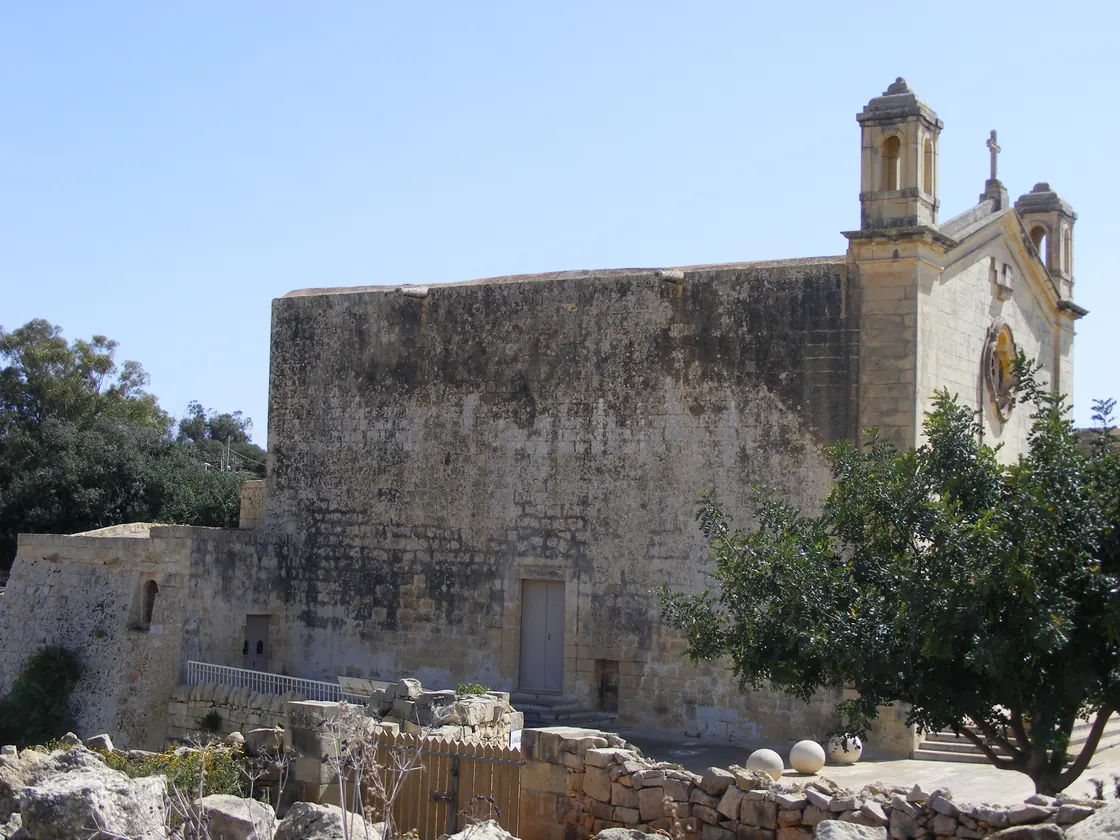
Stone wall and bell towers of St Matthew’s church beside trees and a low limestone wall.
St Matthew’s church, 2 May 2024. Pygar1954 / Wikimedia Commons · CC BY-SA 4.0. Resized and converted to WebP.

Ħaġar Qim and Mnajdra

These are two distinct sites in the same archaeological park and part of UNESCO’s Megalithic Temples of Malta. Heritage Malta describes an internal path between them. Check the park’s visitor information for access, admission and the different terrain at each site.

Heritage Malta visitor information ↗
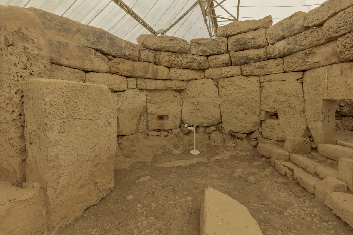
Megalithic stone walls beneath the protective canopy at Ħaġar Qim.
Ħaġar Qim, 25 August 2021. Diego Delso / Wikimedia Commons · CC BY-SA 4.0. Resized and converted to WebP.

Blue Grotto by boat

The sightseeing boats leave from the quay at Wied iż-Żurrieq. The shore viewpoint, the quay and Żurrieq’s village centre are separate destinations. Check the weather and the operator’s notice before travelling to the quay.

Blue Grotto Boat Service ↗

Everyday Qrendi

For a village visit, start with the centre. For the temples or coast, look up the specific site and stop.

Local health services

Qrendi falls within Kirkop Health Centre’s catchment. Check where your service is provided and how to book.

Primary HealthCare directory ↗

Three food addresses

These businesses appear in the Malta Tourism Authority register. Check current opening hours and menus with the venue, especially if planning around a temple visit or boat departure.
Locate the village centre

The marker identifies the Church of the Assumption in the village street network.

Map data © OpenStreetMap contributors.

Sources and nearby editions

Reviewed 16 November 2026. The Address Registrar lists Il-Qrendi as a separate locality in the Western Region.

Nexus Marketplace

Explore Il-Qrendi

See local homes and explore food, shops and everyday places around the neighbourhood.

Homes in Il-Qrendi

Browse local listings

Places around Il-Qrendi

Mapped places within 2 km of the centre. This can include nearby neighbourhoods.

Explore other neighbourhood editions